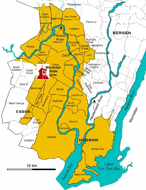
Passaic River Maps
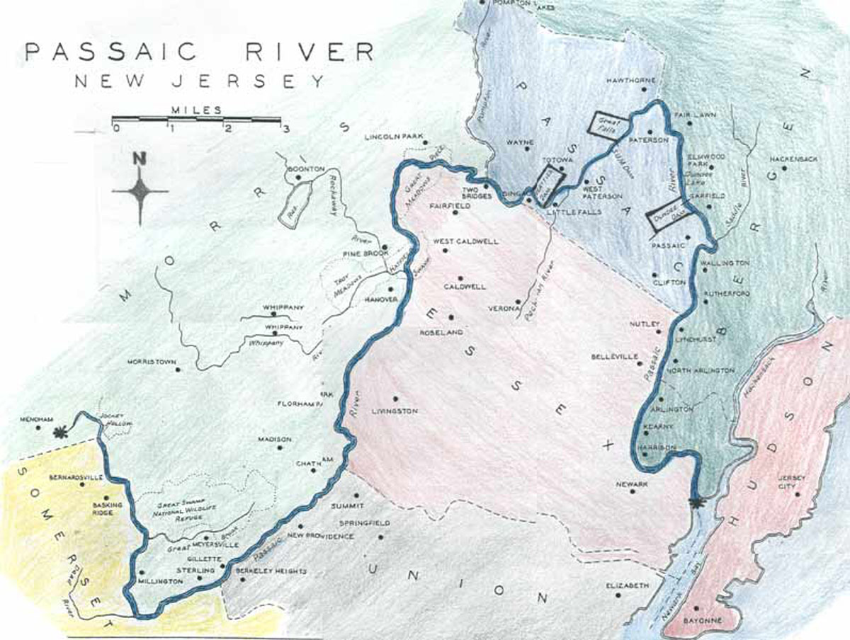
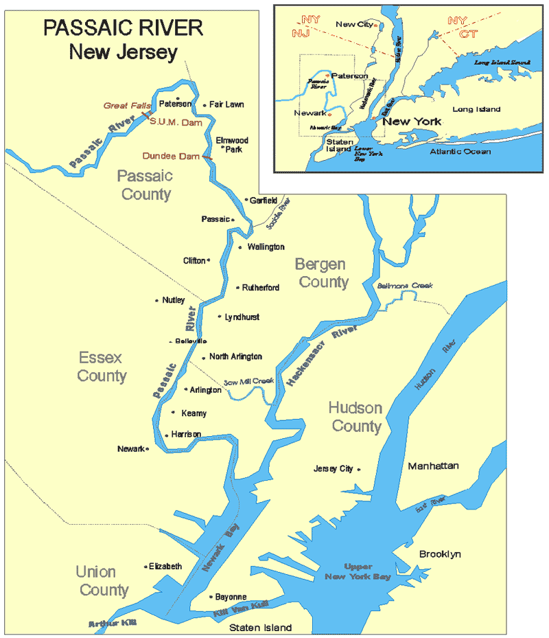
Nice Map of Unknown Origin But Has Some Inaccuracies.
Scale Is Wrong and Kearny and Harrison Are In Hudson County.

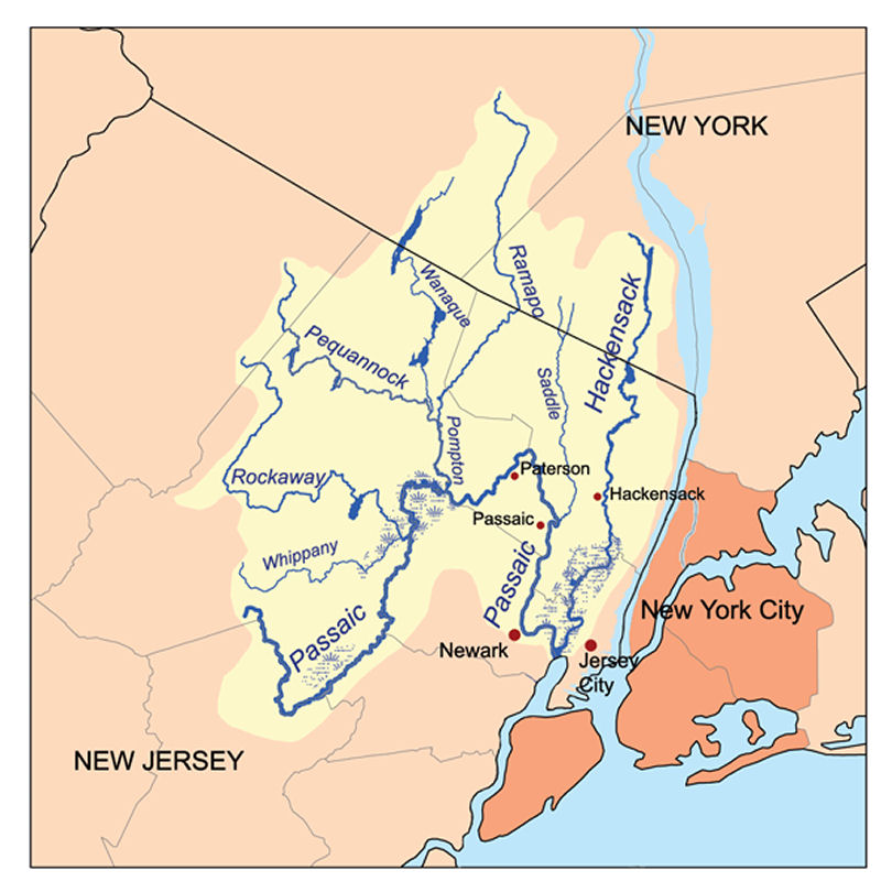
Watershed of the Passaic River
Geological Survey of New Jersey 1877
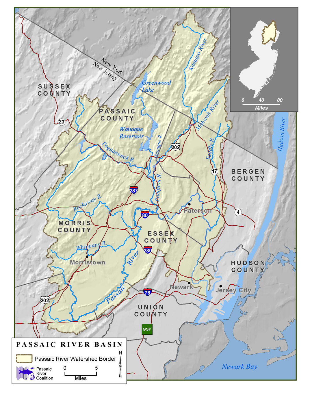
Passaic River Basin
Passaic River Coalition
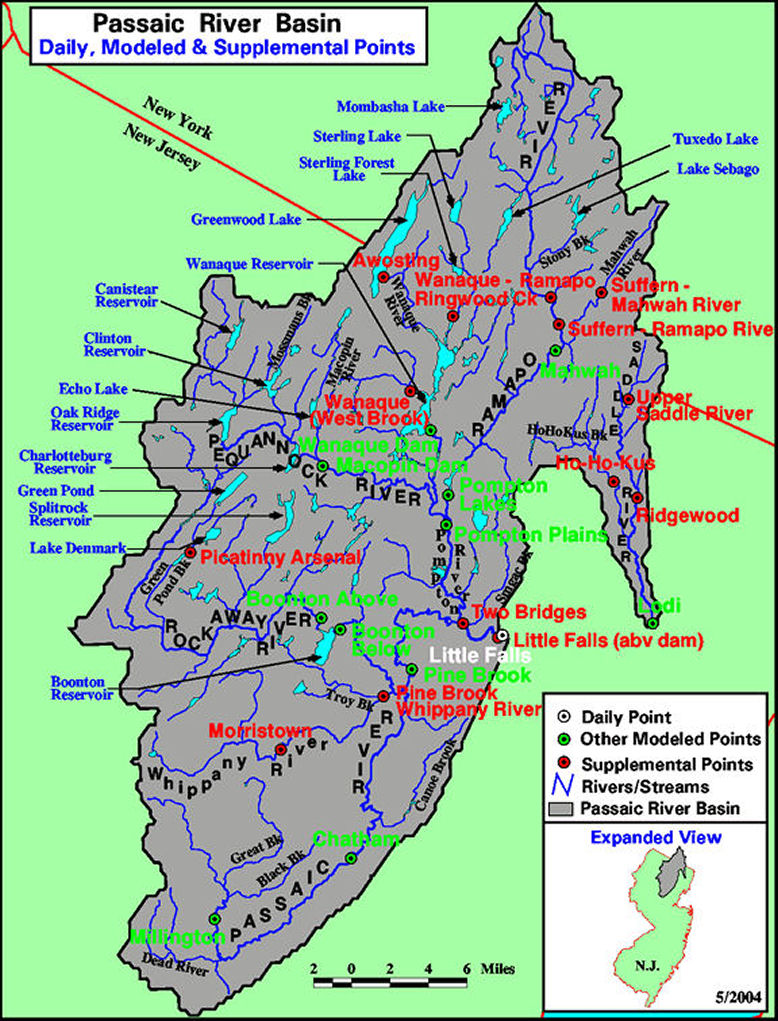
Passaic River Basin
National Oceanic Atmospheric Administration
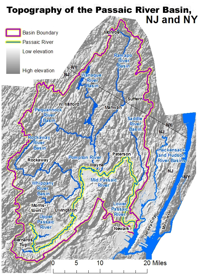
Topography of the Passaic River Basin
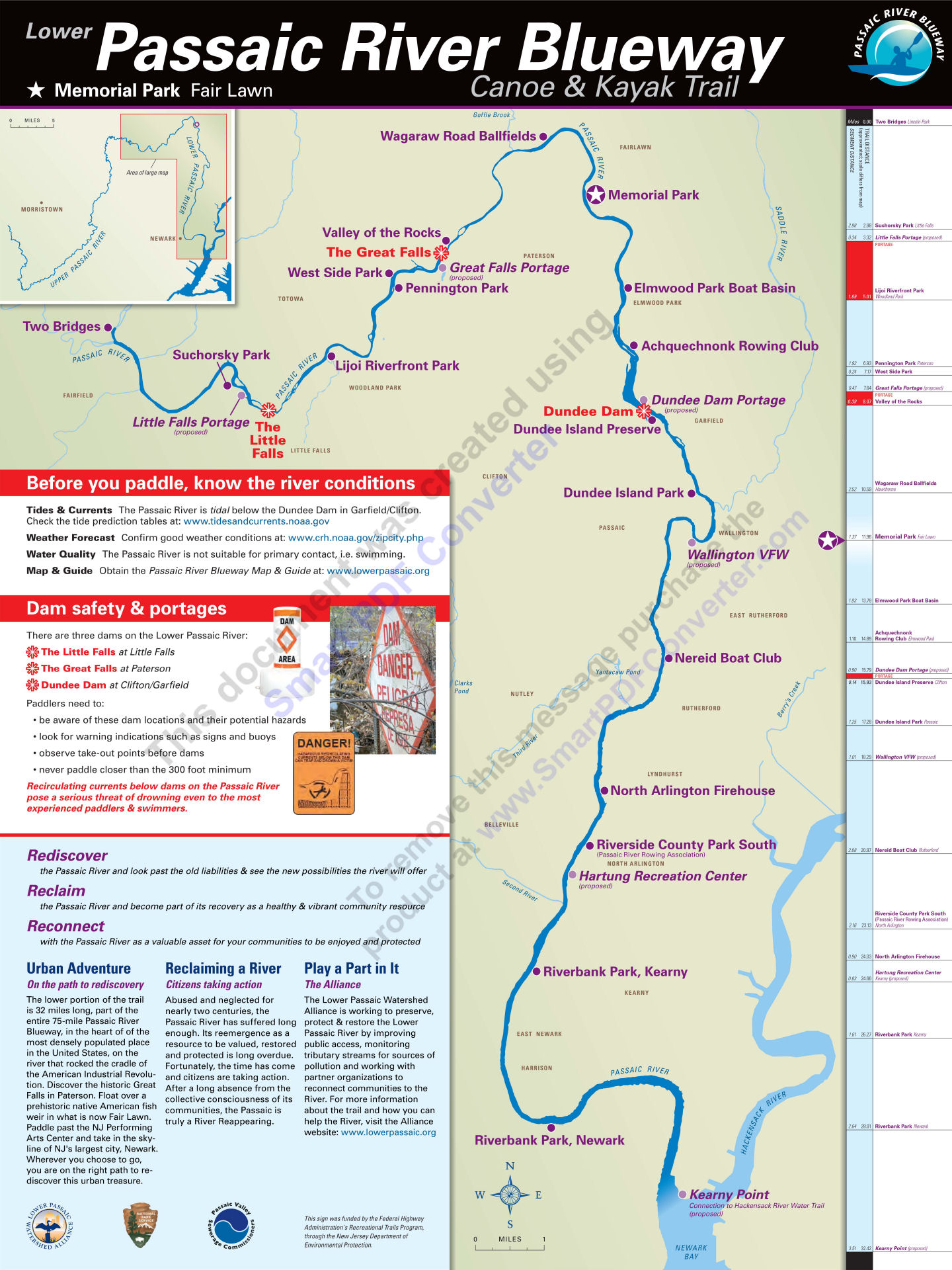
Lower Passaic River Blueway
Canoe and Kayak Trail

Drainage Areas of the Passaic River
Passaic Valley Sewerage Commision 1897
Mapmakers.Rutgers.edu
Lower Passaic River Below Little Falls
UrbanHabitats.org

Brooks in the Paterson Area
Passaic and Hackensack River Basins
Passaic, Hackensack, Hudson and Raritan Rivers
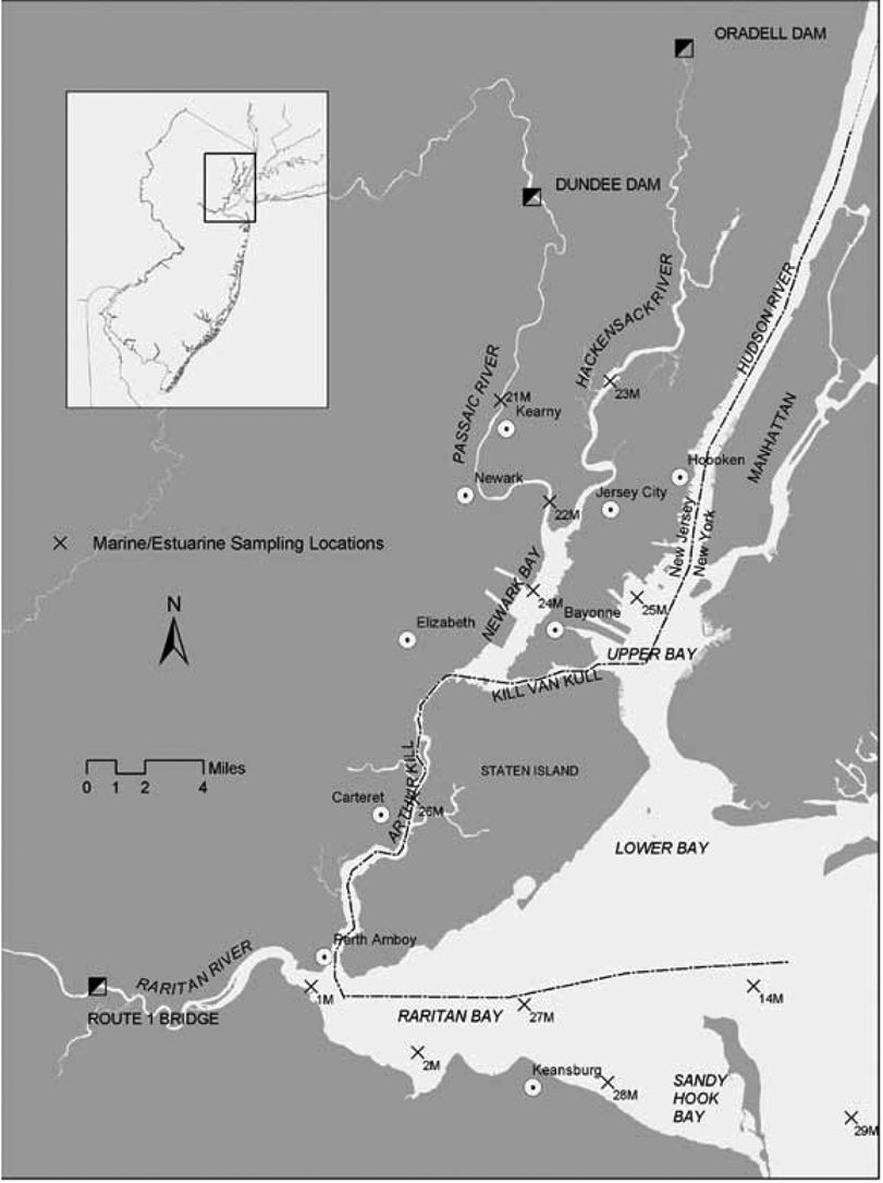
Lower Passaic River
Montclair State University
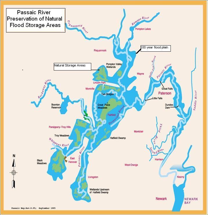
Passaic River Preservation of
Natural Flood Storage Areas
Army Corp Of Engineers
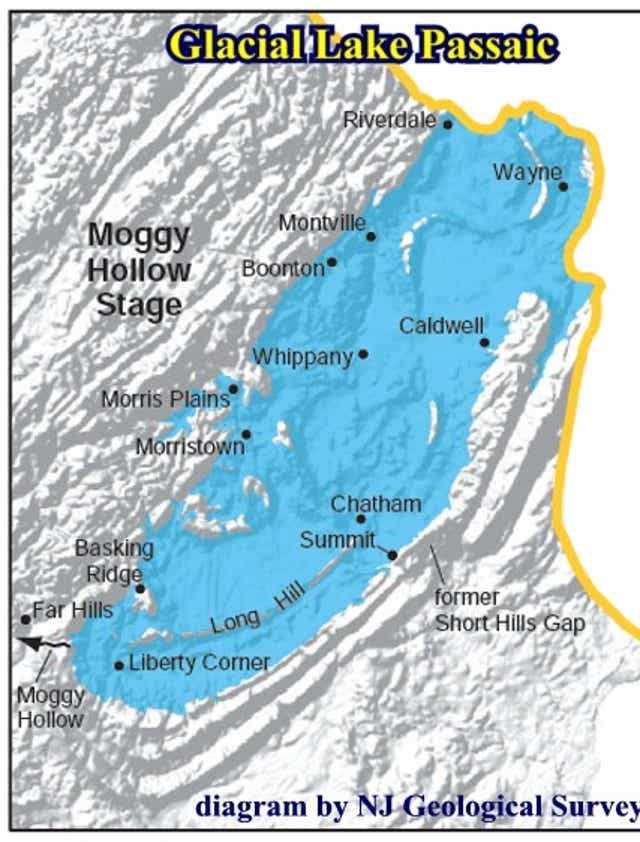
Glacial Lake Passaic
New Jersey Geological Survey
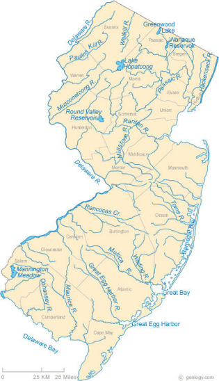
New Jersey Rivers
Geology.com
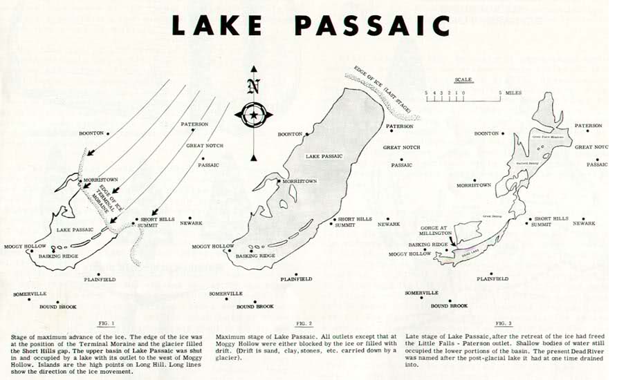
Glacial Lake Passaic

Morris Canal of New Jersey 1827
Mapmaker.Rutgers.edu
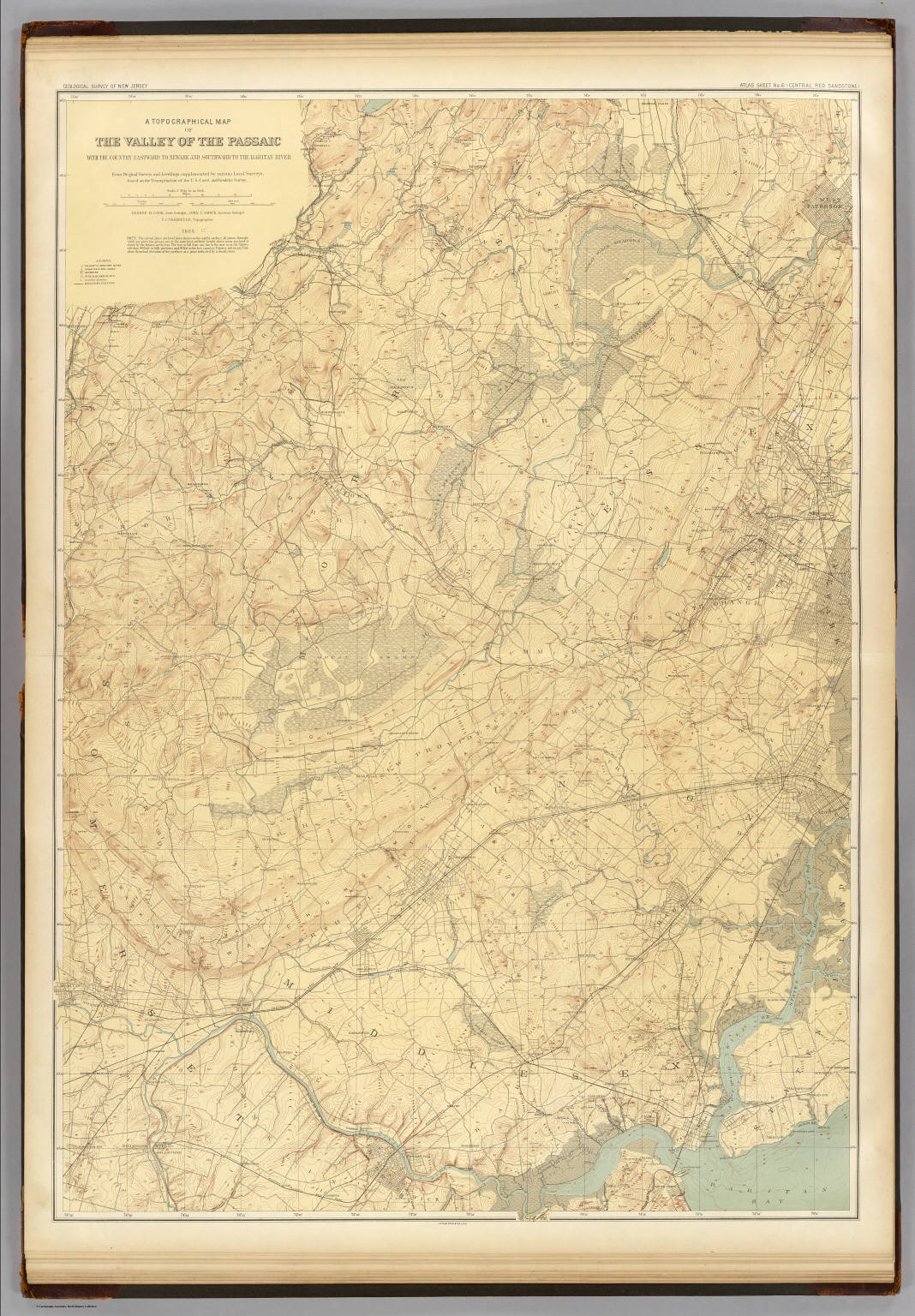
Topographical Map of the
Valley of the Passaic
Geological Survey of New Jersey 1885
David Rumsey Map Collection
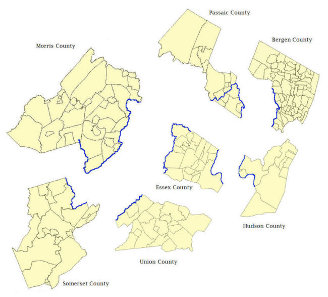
Passaic River Through Seven Counties
National Renewable Energy Laboratory River Atlas
Bing Maps - Good Satellite Views
Google Maps - Better At Providing Names of Brooks and Streams
National Geographic - Good Satellite Views